Manorville Hills
Location
County Road 111 (south/east of Halsey Manor Road)
Manorville, NY
Description
Manorville Hills County Park is a newly established Suffolk County Park that is located in one of the largest expanses of open space left on Long Island - 6,000 acres of land owned and managed between Suffolk County and NYS DEC (Otis Pike Pine Barrens State Forest (formerly Navy Cooperative Area)) in the core of the Long Island Central Pine Barrens. Suffolk County maintains a small parking lot off of the Hot Water Street exit area (Google Maps) on Suffolk County Route 111 (just southest of Halsey Manor Road). Here there is access to a number of blazed trails (including the 125-mile long Paumanok Path, that stretches from Rocky Pointh to Montauk), miles of unblazed trails and woods roads, a 13 mile mountain bike trail (in conjuction with CLIMB) and a designated horse trail.
The terrain is fairly rugged (by Long Island standards) since the area was formed by the edge of the Wisconsin Stage Pleistocene glaciers. Debris (including large, seemingly randomly placed glacial erratics) was deposited around 22,000 years ago by glaciers as they stopped, melted and started receding. The Manorville Hills are located along the Ronkonkoma terminal moraine (the line of debris left at the southernmost edge of the glacier), which forms what is now the spine of Long Island and its South Fork (Geology of Long Island). The topography is considered "knob and kettle", consisting of various mounds (the knobs) and depressions (the kettles) formed when blocks of ice left behind by the glaciers melt (which may or may not be presently water-filled).
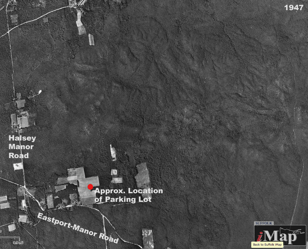
In more recent history, the Manorville Hills have been the site of a few small-scale farms, which were located along what was Eastport-Manor Road (which has been replaced with CR 111). The cleared fields are undergoing succession and are slowly returning to a more natural state. RCA had a radio tower atop Dietz Hill for a short amount of time and the remnants of the tower base, paved access road and telephone poles still remain. Old woods roads crisscross the area along with many unmarked and a few blazed trails. The area is expansive, which is great for getting away from the rush of Long Island, but can quickly turn into a maze of winding trails and narrow tracks that can soon look all the same. Make sure you know where you're going!
Marked Trails
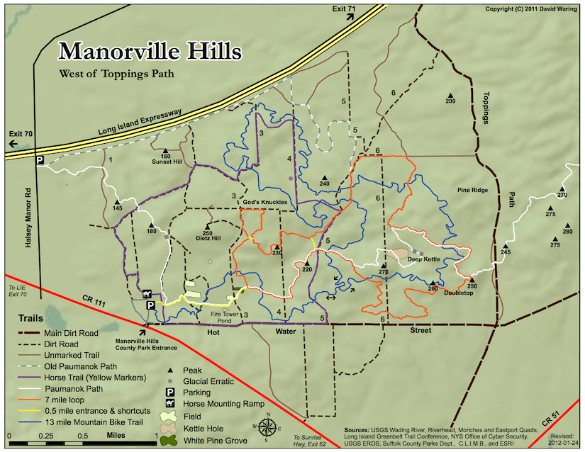
Paumanok Path - White Blazes
The Paumanok Path takes an E/W cross section through the Manorville Hills starting where Halsey Manor Road crosses the LIE, crosses Topping's Path and eventually reaches CR 51 near Suffolk County Community College (a distance of about 10 miles). The Path has recently been rerouted away from the LIE (which is great!) and takes a more southerly route, quickly passing a couple of small kettle holes and climbs a couple of relatively large hills that can offer a bit of a view of the surrounding area through the trees. The Path will meet up with the Yellow-blazed entrance trail near the Manorville Hills County Park trailhead and follow this past a few old fields and enters a dense stand of White Pines. Just past the White Pines the yellow trail ends and the orange loop trail starts. The Path follows the orange-blazed trail east for a while before splitting off to head towards Deep Kettle, a large kettle hole depression. The Path soon meets up with the orange trail again and heads south towards Doubletop, but heads off to the east before the summits. Heading east, the Path crosses the wide Topping's Path and enters the Eastern section of Manorville Hills.Entrance Trail - Yellow Blazes
At the Manorville Hills County Park trailhead starts the yellow-blazed entrance trail. This trail is approximately 1/2 mile long and connects the parking area with the 7 mile orange-blazed loop trail and follows the Paumanok Path for most of its route. The trail passes through an area that used to have a few small farms and the remnants of human activity are clearly visible, including old roads and fields. The end of the trail crosses through the middle of a fairly large and dense stand of White Pines, which must have been planted at some point. If anyone knows the history of this spot, I'd love to learn more. Just past the White Pines, the trail ends at the orange-blazed loop trail begins.
NOTE: There are two shortcut trails along the orange loop that are also blazed yellow.Loop Trail - Orange Blazes
At the end of the yellow trail (1/2 mile), starts the roughly 7 mile long loop trail. Combined this makes about an 8 mile hike, but there are numerous locations (including two yellow-blazed shortcut trails and a few numbered woods roads) that can be used to shorten the loop. This is a very scenic and meandering trail that climbs and descends countless hills, some of which can offer fairly decent views (particularly when the leaves have dropped).Bike Trail - Blue Blazes
The Concerned Long Island Mountain Bicyclists (CLIMB) were largely responsible for developing and creating this 13 mile mountain bike trail. The trail is blazed blue and starts from the Manorville Hills County Park parking lot. For more information and current trail conditions, visit the CLIMB website (Manorville Hills Forum)Horse Trail - Yellow Horse Trail Markers
I don't have much information on the route of the horse trail. If you, or anyone you know, has ridden or plans or riding the trail, and would like to help me add the trail to the map, please get in touch!
UPDATE: I got a general route description for the horse trail, but if anyone notices any errors or has any more detailed information, let me know!
Maps
The following maps are for the Western section of Manorville Hills (west of Topping's Path - the N/S woods road the bisects the area). Click on each map to download a full-resolution PDF copy.
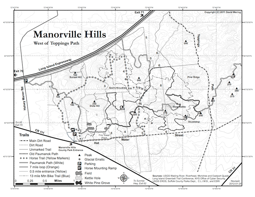
IMPORTANT NOTE: These maps are accurate to the best of my abilities. The blazed trails were tracked using a GPS device and the woods roads were referenced from aerial photography and as such, these should be fairly accurate. However, many of the non-blazed trails (including the older portions of the Paumanok Path) are estimated based on older maps and may not be as accurate in their actual geographic locations. These maps, although fairly detailed, are meant for general reference purposes. If you need a highly accurate map, the USGS topo maps are the way to go (although the ones for this area are quite old).
If you notice any discrepancies or come across trails that you think should be added, please let me know!
Color Trail Map
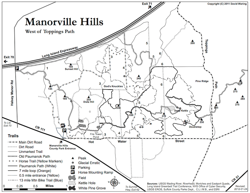
Black and White Trail Map
Black and White Topo Map
Photos
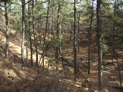
A small kettle hole along the Paumanok Path near Halsey Manor Road
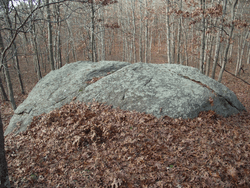
A glacial erratic along the Paumanok Path
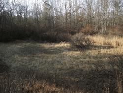
A fairly shallow and grassy kettle hole near the old farm fields
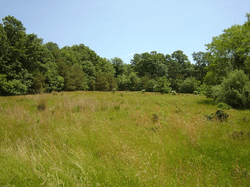
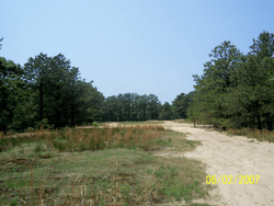
An old farm field
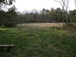
A grassy field, possibly an old farm field, along the Paumanok Path and Yellow trails
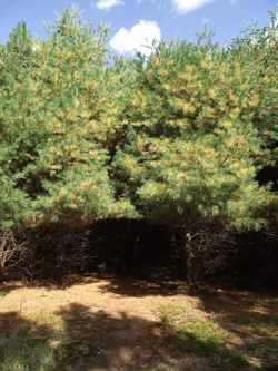
The White Pine stand along the Paumanok Path and Yellow trails
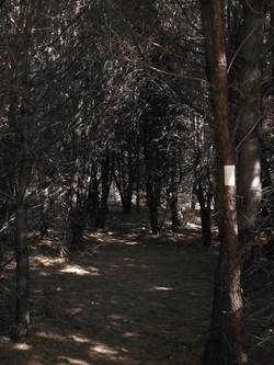
The trail goes through the middle of the White Pine stand
The old paved access road to Dietz Hill, where the RCA radio tower once stood
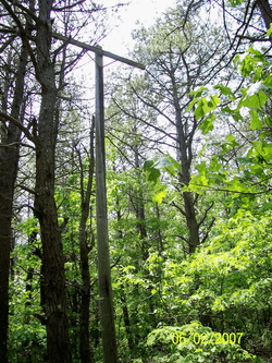
An old telephone pole still stands reunited among the trees
The top of Dietz Hill, where the base of the RCA radio tower once stood
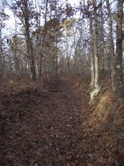
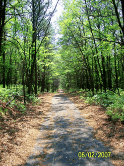
The Paumanok Path